

Celebrate the big 6 with unique personalised prints


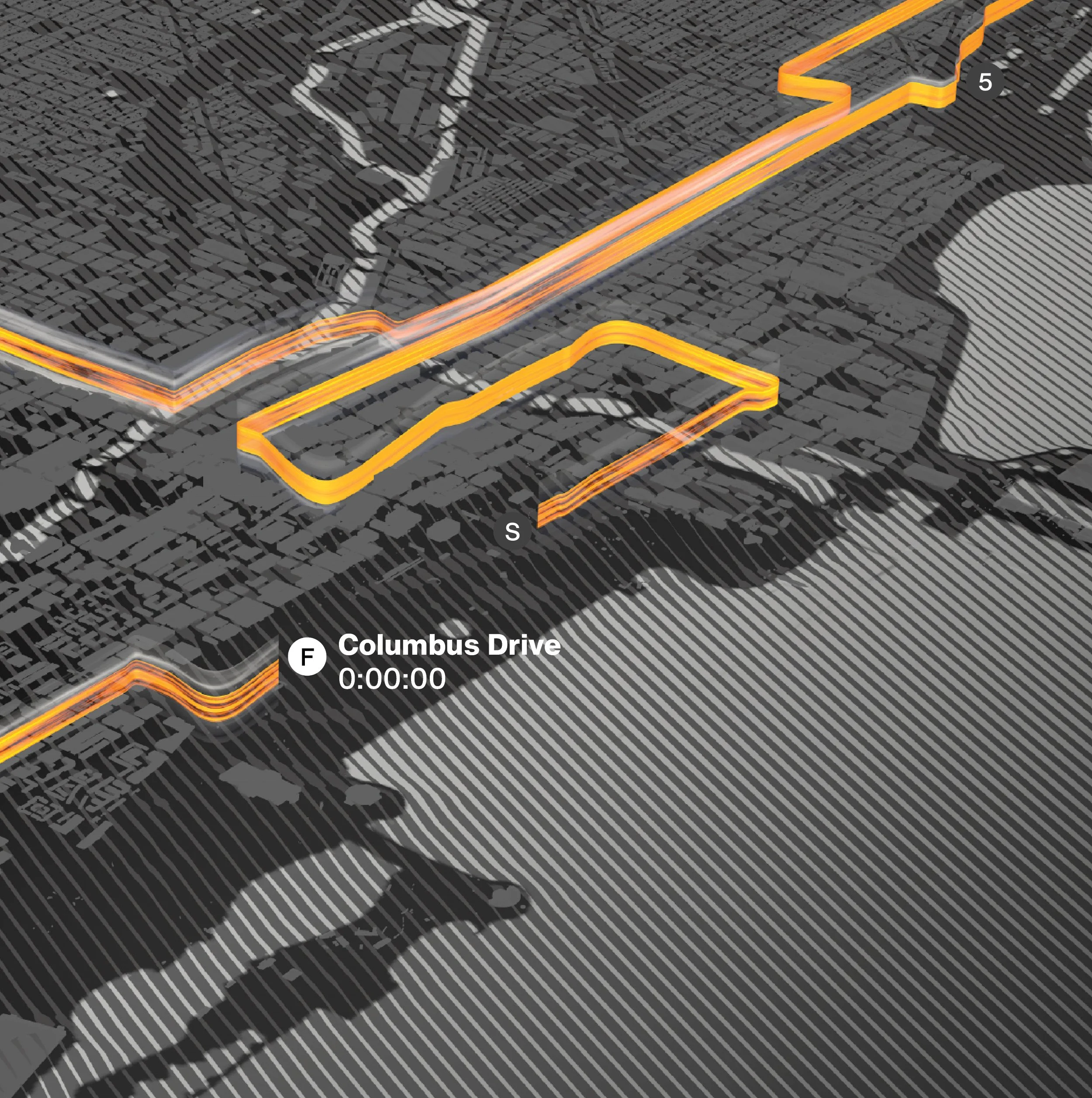


Anatomy of a Loopie
-
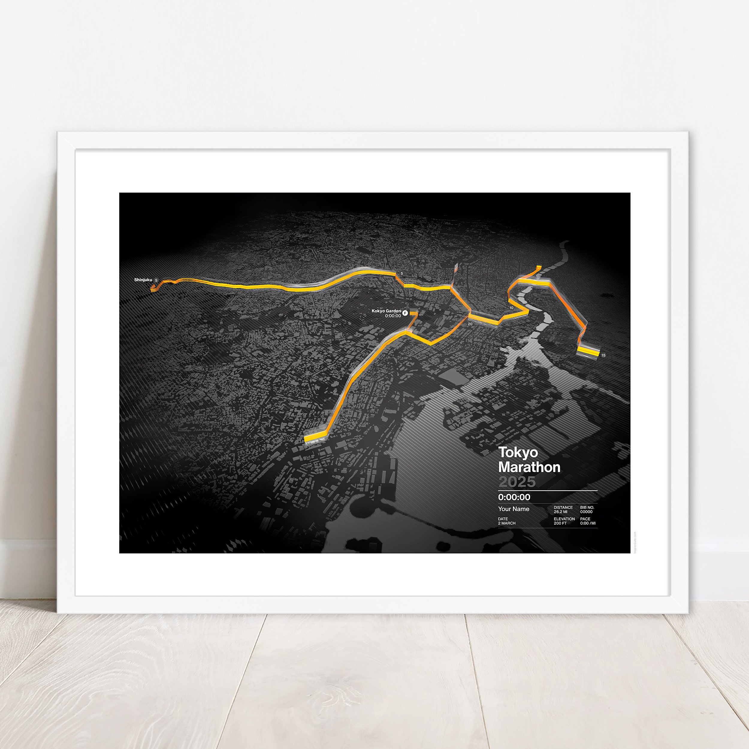
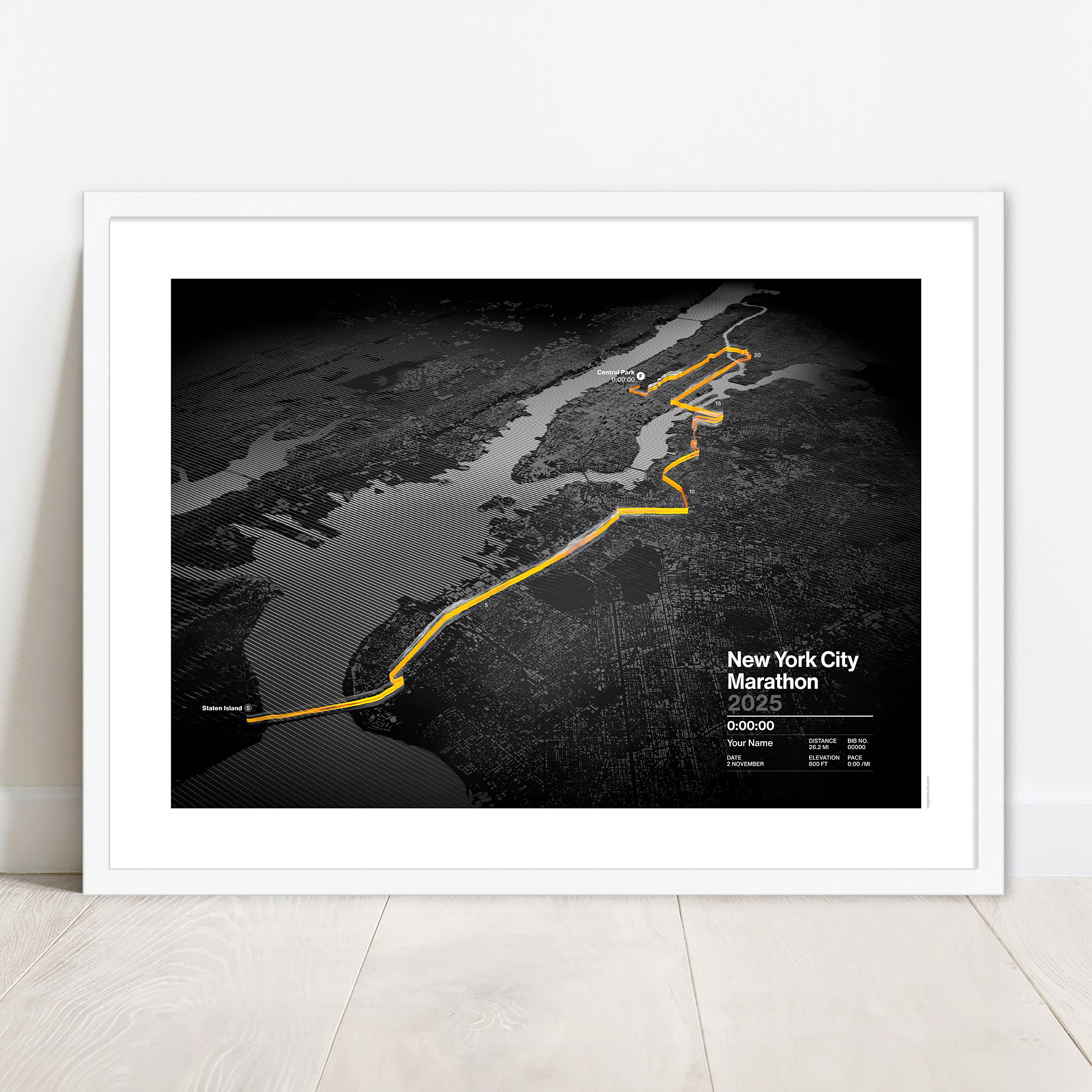
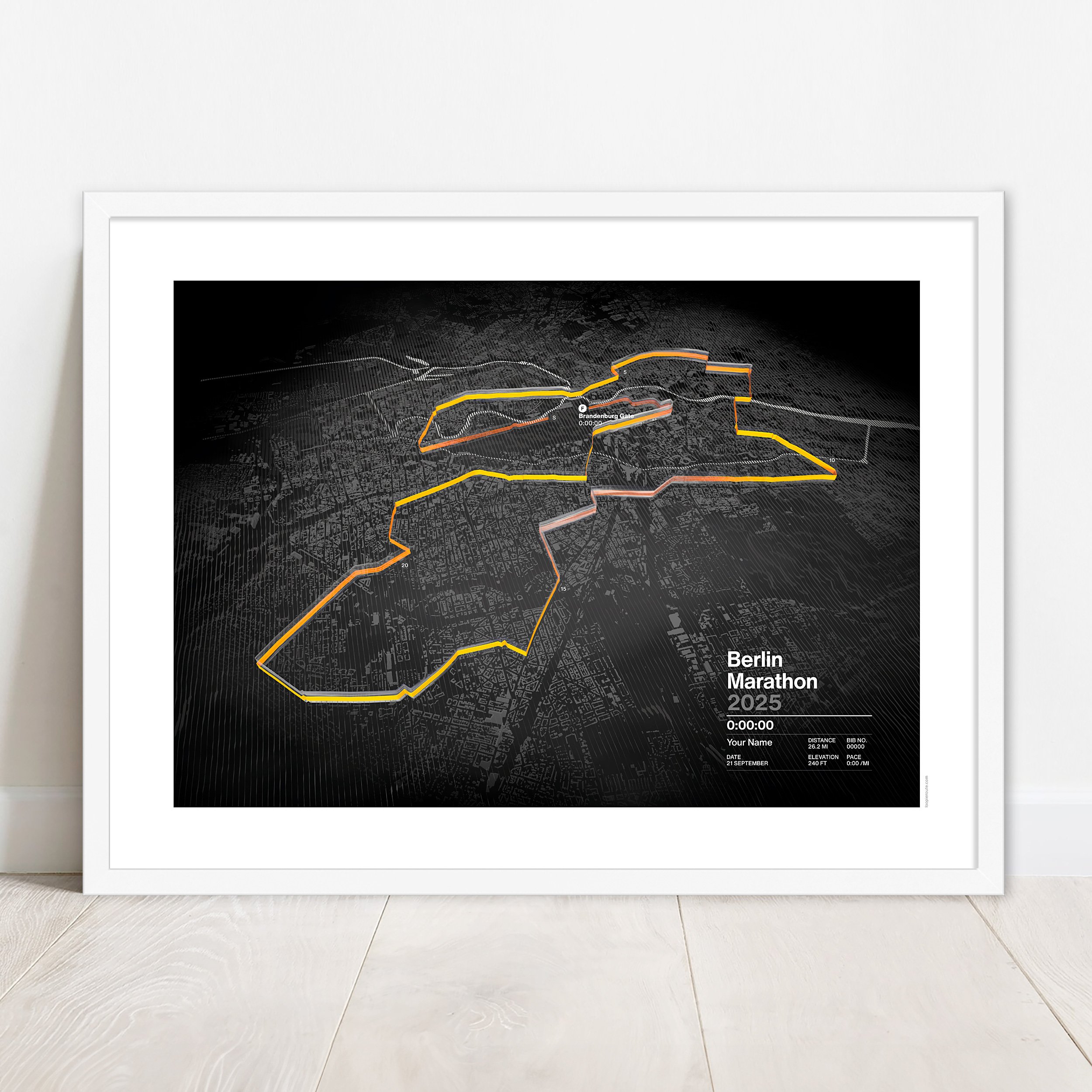
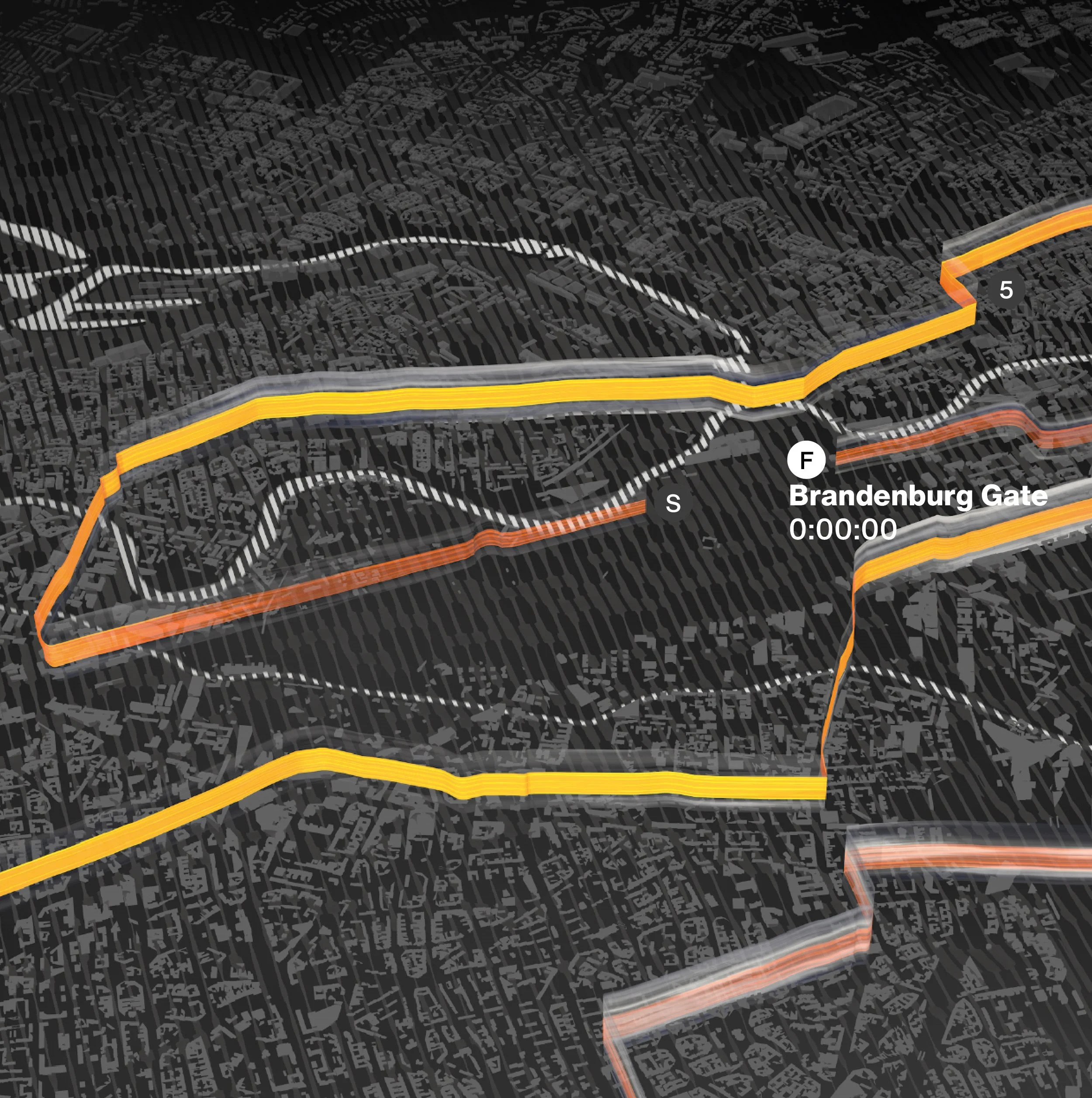
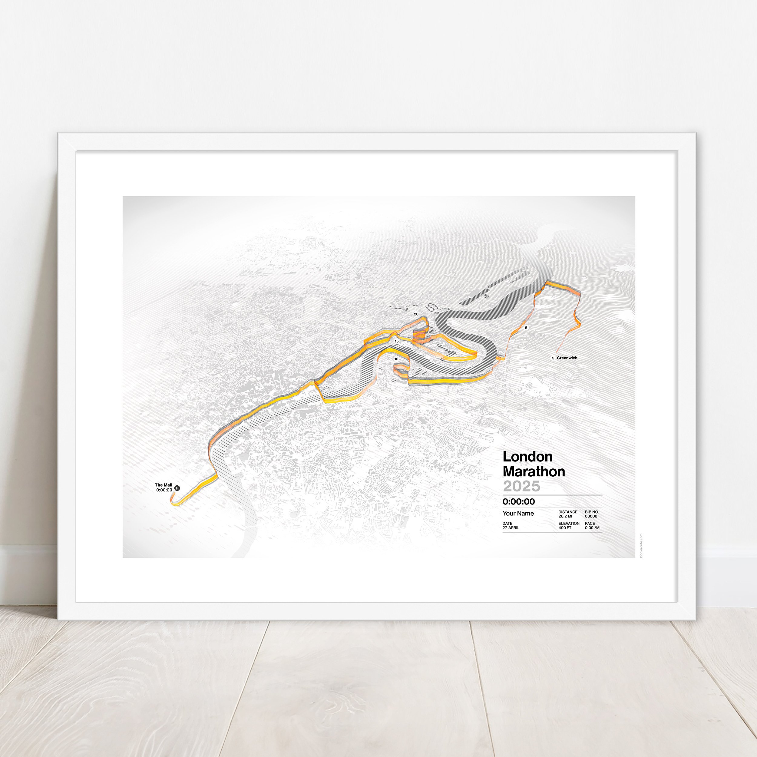
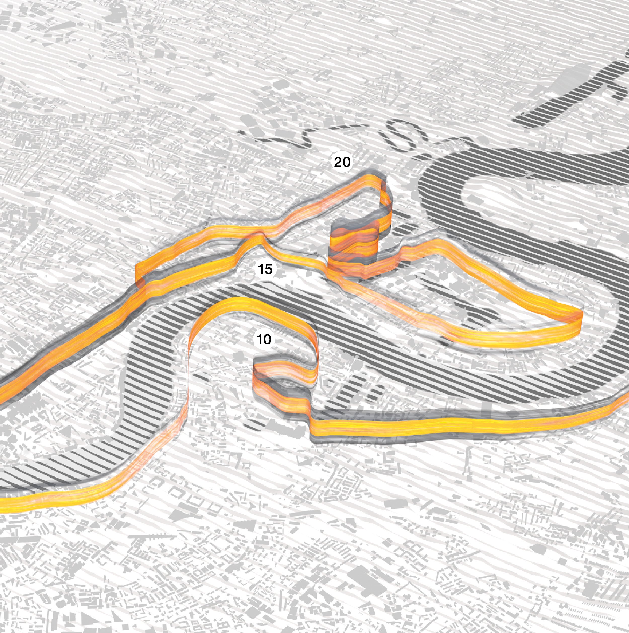
All Loopie prints are created from actual GPS data. They accurately capture the route, location, terrain and elevation for an exact image of the event. We can also create prints from any GPS file. We’d love to hear from you if you have an event you’d like to celebrate.
-
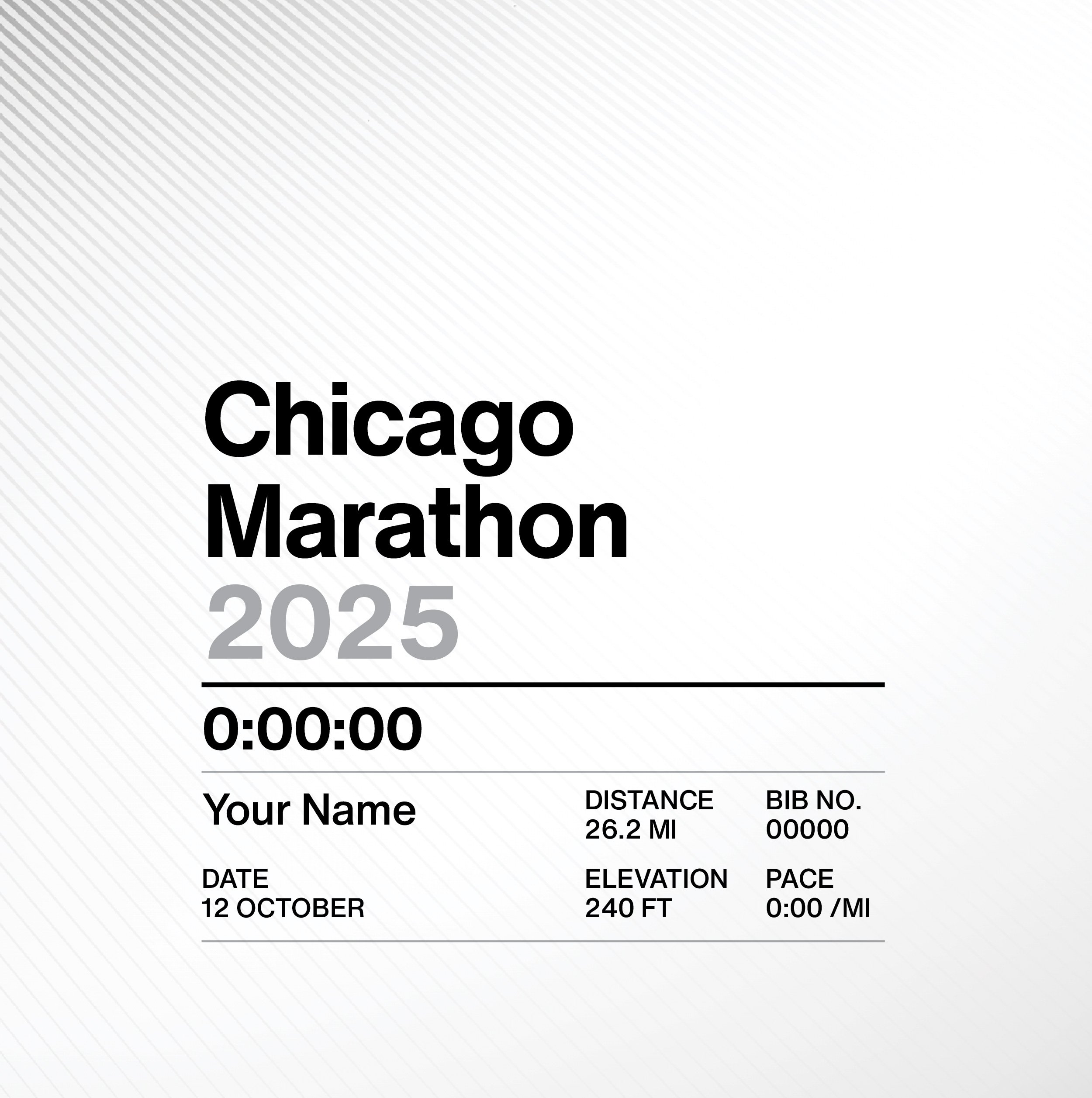
Each print can be personalised with your name, finishing time, pace and bib number to create a truly unique and memorable piece of artwork. Loopies are a very bespoke product, let us know what you want and we’ll try to accommodate.
-
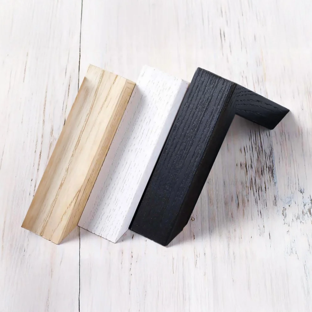
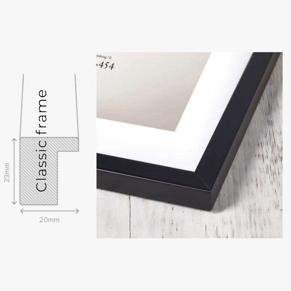
All Loopies are professionally produced using fine art Giclee printers on gallery quality art paper. This ensures the highest quality finish and colours that do not fade. Order your Loopies ready to hang with handmade wooden frames, available in black, white or a natural finish.